McCabe & Mrs. Miller: The Map
November 12th, 2016
In the lines of the previous map of the Once Upon a Time in the West opening scene, me and Tero started a bit larger undertaking: the map of Presbyterian Church, the mining town where Altman’s McCabe & Mrs. Miller (1971) takes place. Mapping a complete – and messy – town turned out significantly trickier than just one yard, but here’s version 1.0 and my original sketch for your pleasure:
-

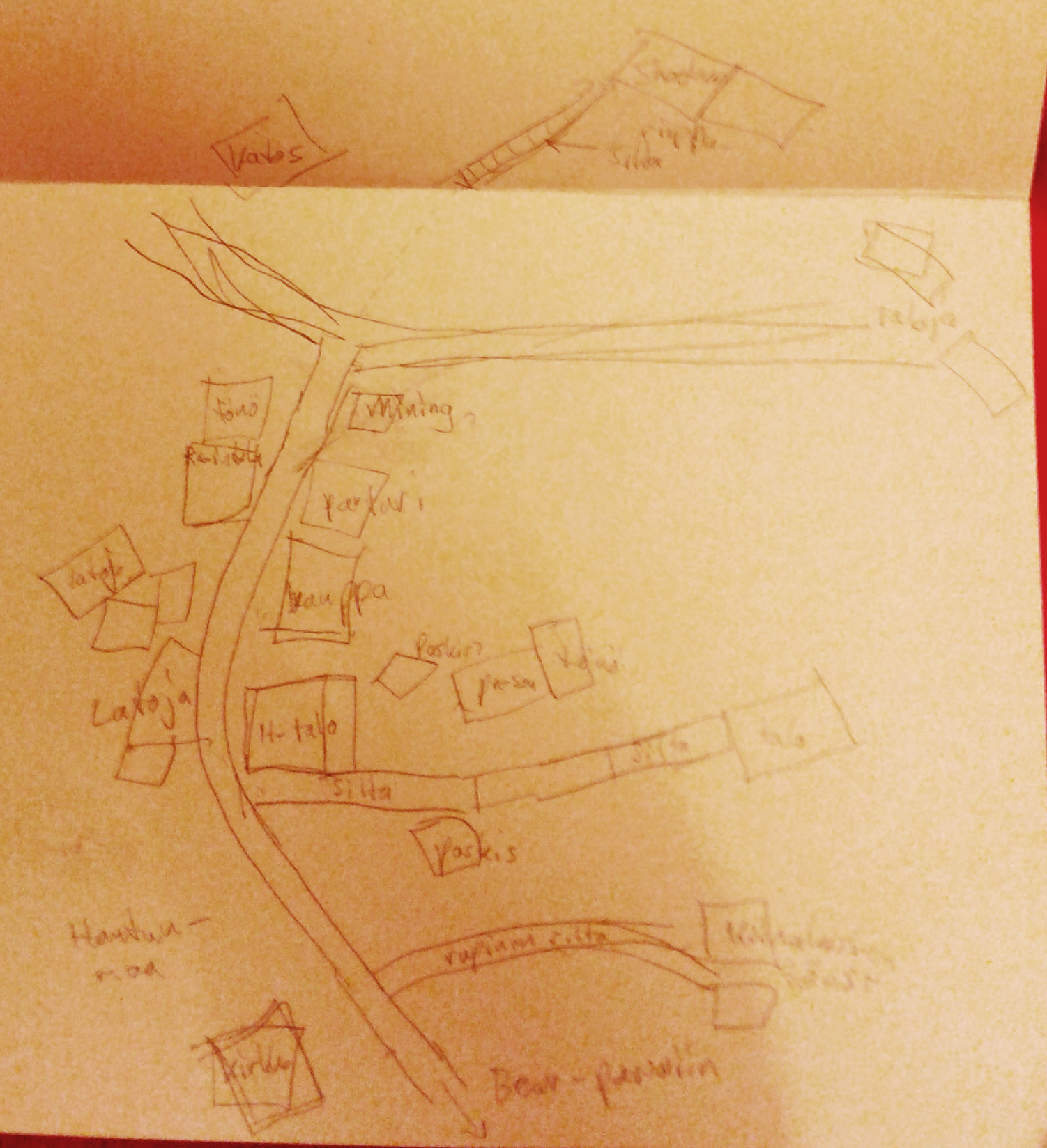
- First sketch
-
- Map 1.0
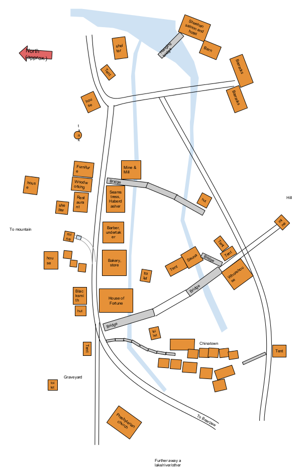
And a scalable pdf file for checking the details better and printing. There are some dead angles that are not visible, so the exact placement of roads and rivers is rather preliminary. Likewise, most buildings aren’t exactly to scale. Another thing to note is that the map represents the situation at the end of the movie – the town keeps growing and changing a lot throughout the movie, starting from not much more than a few huts and shelters.
Filed under: leffat,sekalaista,visuaalit
Kommentin kirjoitus
You must be logged in to post a comment.
RSS feed for comments on this post.